|
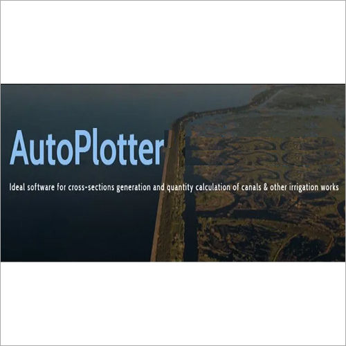
Auto Plotter Softwares
90000 INR/Number
Product Details:
- Usage Professional
- Security Features Password Protection, Data Encryption
- Capacity (Person) Single/Multiple Users
- Language Support English, Hindi
- Support System Online/Software Support, Tutorials
- Compatible System Windows (All Versions)
- Interface Type Graphical User Interface (GUI)
- Click to View more
X
Auto Plotter Softwares Price And Quantity
- 90000 INR/Number
- 1 Number
Auto Plotter Softwares Product Specifications
- Graphical User Interface (GUI)
- Windows (All Versions)
- Engineering Design, Civil Survey Plotting, Mapping, and Drafting
- Single/Multiple Users
- English, Hindi
- Password Protection, Data Encryption
- Professional
- Online/Software Support, Tutorials
- Plotting Software
- 600 DPI and above
- DWG, DXF, DGN, SHP, CSV
- Perpetual / Annual Subscription
- PDF, Print, Plotter Ready
- Yes
- LAN/WAN Compatible
- Supports AutoCAD, MicroStation
- Custom Macros and Templates
- Pentium IV or Higher, 2GB RAM Minimum, 1GB Free Disk Space
- Automatic / Manual Update
Auto Plotter Softwares Trade Information
- 1 Number Per Week
- 1 Week
- All India
Product Description
The Auto Plotter Softwares are general application with powerful features for faster and accurate land survey data processing. Whether people want to get their topographical map with contours and 3D terrain model, or they are looking for sections, or cadastral maps, AutoPlotter can do it all for people in a way which they will always appreciate, the easy way.
Seamless Integration and Compatibility
Auto Plotter Software supports comprehensive integration with popular CAD platforms like AutoCAD and MicroStation, enabling users to work effortlessly within their existing workflows. Its compatibility with all Windows versions and support for multiple file formats ensures unmatched flexibility. Whether you are plotting engineering designs or civil survey data, this solution fits seamlessly into your system architecture.
Advanced Output and Customization Options
Produce professional-grade plots with output options including PDF, direct printing, and ready-to-plot formats. Customize your experience using powerful macros and templates tailored for engineering and mapping requirements. High print resolutions (600 DPI and above) guarantee clear, detailed results, making it an essential tool for precision-driven professionals.
Security, Support, and Network Performance
Safeguard your data with integrated password protection and encryption. Auto Plotter Software supports both LAN and WAN, making it ideal for offices of any size. Users benefit from dedicated online/software support, detailed tutorials, and a graphical user interface designed for ease of use, streamlining training and adoption for both single and multiple users.
FAQ's of Auto Plotter Softwares:
Q: How does Auto Plotter Software ensure compatibility with various CAD file formats?
A: Auto Plotter Software is engineered to import and export widely-used design formats such as DWG, DXF, DGN, SHP, and CSV. This facilitates smooth data exchange and integration with platforms like AutoCAD and MicroStation, streamlining your engineering and mapping projects.Q: What process should I follow to update the software, and are updates automatic?
A: You can update Auto Plotter Software either automatically or manually, depending on your preference. The automatic update feature ensures you always have the latest improvements, while manual updates can be initiated through the software's interface whenever needed.Q: Where can I get technical support and learning resources for this software?
A: Technical support is available online, via software-based help, and through tutorials. These resources guide users through installation, customization, troubleshooting, and advanced usage, making onboarding accessible and efficient for all skill levels.Q: What are the primary benefits of the customization features provided?
A: Custom macros and templates allow users to automate plotting tasks, standardize project workflows, and tailor the software to unique engineering or surveying requirements. This leads to improved efficiency and consistency across multiple projects.Q: When is it advisable to use the network capability of this software?
A: LAN/WAN compatibility enables collaborative work environments, allowing multiple users to access and manage projects within an office or across different locations. This is recommended for teams needing centralized data management and shared plotting resources.Q: How does the software maintain data security during project work?
A: The software utilizes password protection and data encryption to ensure your engineering and mapping data remain secure throughout usage and storage, meeting the stringent requirements of professional and enterprise environments.Q: What are the system requirements and who can use this software?
A: Auto Plotter Software requires at least a Pentium IV or higher processor, 2GB RAM, and 1GB free disk space. It supports all versions of Windows and accommodates both single and multiple users, making it suitable for professionals in engineering, surveying, and mapping fields in India.Tell us about your requirement

Price:
Quantity
Select Unit
- 50
- 100
- 200
- 250
- 500
- 1000+
Additional detail
Mobile number
Email

Other Products in 'Engineering Software' category


Address
GST : 24ALKPS7170A1Z5
- 504, Supath, Opp. Rasranjan, Nr. Vijay Cross Road, Navrangpura, Ahmedabad - 380009, Gujarat, India
- Phone :08045815970
- Send Inquiry
 |
MAHAVIR TRADERS
All Rights Reserved.(Terms of Use) Developed and Managed by Infocom Network Private Limited. |
