|
OpenRoads-MX Roads Designer Connect Edition
281309 INR/Unit
Product Details:
- Support System Online and Offline Technical Support
- Compatible System Windows 10/11 (64-bit)
- Interface Type Graphical User Interface (GUI)
- Usage Professional/Industrial
- Security Features Licensed Software with Product Activation
- Capacity (Person) Multi-user access
- Language Support Multilingual
- Click to View more
X
OpenRoads-MX Roads Designer Connect Edition Price And Quantity
- 281309 INR/Unit
- 1 Unit
OpenRoads-MX Roads Designer Connect Edition Product Specifications
- Multilingual
- Road Design Software
- Graphical User Interface (GUI)
- Licensed Software with Product Activation
- Multi-user access
- Professional/Industrial
- Civil Engineering Road Design
- Windows 10/11 (64-bit)
- Online and Offline Technical Support
- Compatible with other Bentley civil software
- Bentley Systems
- 8 GB (16 GB Recommended)
- 3D Modeling, Terrain Modeling, Dynamic Design Capabilities, Corridors, Superelevation, Automatic Drawing Production
- Connect Edition
- Documentation, Video Tutorials, User Forums
- Cloud services support available
- Subscription or Perpetual
- DGN, DWG, DXF, LandXML, GENIO
- Minimum 10 GB free hard disk space
- Intel i5 or higher
- DirectX 11 compatible graphics card
OpenRoads-MX Roads Designer Connect Edition Trade Information
- 1 Unit Per Day
- 5 Days
Product Description
OpenRoads-MX Roads Designer Connect Edition, developed by Bentley Systems, stands as an eminent, hot-selling road design software acclaimed for its immaculate and dynamic capabilities. This popular, feature-packed tool supports DGN, DWG, DXF, LandXML, and GENIO formats, making it preeminent among civil engineering professionals. Its robust toolset includes advanced 3D and terrain modeling, corridor design, superseded superelevation, and automated drawing production. Available via subscription or perpetual license, it offers seamless integration with Bentley civil software, supports cloud connectivity, multi-user access, and ensures licensed security-ideal for professional and industrial use across India.
Application Surface and Versatile Usage
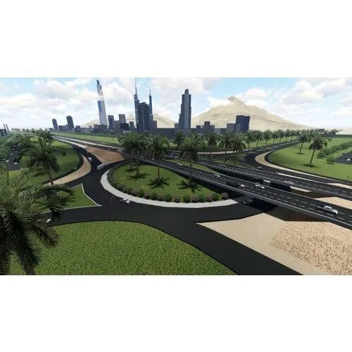
OpenRoads-MX Roads Designer Connect Edition is optimal for a variety of civil engineering plant applications. Its immaculate design enables precision in constructing graded surfaces, corridors, and complex road alignments. Used by eminent dealers, service providers, and wholesalers, the software drives projects ranging from highways to industrial access roads. By offering robust modeling, it meets industry requirements for surface optimization and dynamic infrastructure development, reaffirming its reputation as a preeminent solution for professional civil engineering projects.
Export Market, Packaging, and Transport Services
With an estimated demand in both domestic and international markets, OpenRoads-MX Roads Designer Connect Edition is packaged meticulously to ensure product safety during transit. Export packaging details are crafted for optimal protection, and orders are dispatched through reliable transport services, guaranteeing timely delivery. The principal FOB port for shipments is in India, offering easy logistics handling. As a hot-selling product, it is a preferred choice for bulk buyers, traders, and suppliers seeking seamless procurement and delivery.
Application Surface and Versatile Usage
OpenRoads-MX Roads Designer Connect Edition is optimal for a variety of civil engineering plant applications. Its immaculate design enables precision in constructing graded surfaces, corridors, and complex road alignments. Used by eminent dealers, service providers, and wholesalers, the software drives projects ranging from highways to industrial access roads. By offering robust modeling, it meets industry requirements for surface optimization and dynamic infrastructure development, reaffirming its reputation as a preeminent solution for professional civil engineering projects.
Export Market, Packaging, and Transport Services
With an estimated demand in both domestic and international markets, OpenRoads-MX Roads Designer Connect Edition is packaged meticulously to ensure product safety during transit. Export packaging details are crafted for optimal protection, and orders are dispatched through reliable transport services, guaranteeing timely delivery. The principal FOB port for shipments is in India, offering easy logistics handling. As a hot-selling product, it is a preferred choice for bulk buyers, traders, and suppliers seeking seamless procurement and delivery.
| Type | Online/Cloud-based |
| Operating System | For Windows |
| Download Option | Free Download Available |
| Programming Language | P H P |
| Training | Live Online, Documentation, In Person |
| License Duration | 1 Year |
| Support | Online |
| Mobile App | For Windows |
FAQ's of OpenRoads-MX Roads Designer Connect Edition:
Q: How can OpenRoads-MX Roads Designer Connect Edition support my civil engineering projects?
A: This software delivers dynamic 3D and terrain modeling, automated drawing production, and integrated corridor design, making it ideal for complex professional road projects.Q: What file formats are compatible with OpenRoads-MX Roads Designer?
A: OpenRoads-MX supports eminent industry-standard formats such as DGN, DWG, DXF, LandXML, and GENIO, facilitating seamless data exchange and collaboration.Q: When is user training available for OpenRoads-MX Roads Designer?
A: Comprehensive training is available via live online sessions, in-person workshops, software documentation, and user forums to support all user levels.Q: Where can I use the cloud services feature of this software?
A: With cloud connectivity, users can securely access design data and collaborate on projects remotely, streamlining workflow for distributed teams.Q: What is the process for obtaining a license and activation?
A: Licenses are available on a subscription or perpetual basis. Once procured, the software can be activated securely through the product activation process.Q: How does OpenRoads-MX Roads Designer ensure data security?
A: It incorporates licensed software protection mechanisms and product activation to ensure only authorized usage and safeguard project data integrity.Tell us about your requirement

Price:
Quantity
Select Unit
- 50
- 100
- 200
- 250
- 500
- 1000+
Additional detail
Mobile number
Email

Other Products in 'Bentley Software' category


Address
GST : 24ALKPS7170A1Z5
- 504, Supath, Opp. Rasranjan, Nr. Vijay Cross Road, Navrangpura, Ahmedabad - 380009, Gujarat, India
- Phone :08045815970
- Send Inquiry
 |
MAHAVIR TRADERS
All Rights Reserved.(Terms of Use) Developed and Managed by Infocom Network Private Limited. |
